
13.6.2023: With the bicycle around the Mitterberg.
We opt for the largely well designated (except in Tamsweg) bicycle route around Mitterberg ("Mitterbergrunde"), about 35 km, leading around the low ridge inmidst the wide valley of the Lungau.
First, it goes down along the Mur valley bicycle route with view to the Hohe Tauern and Radstädter Tauern ...

... at times directly along the river Mur.

Here, with financial support of the land, the local community has improved the landscape along the river Mur, with grass and benches. Carthusian pink (Dianthus carthusianorum) along the way.

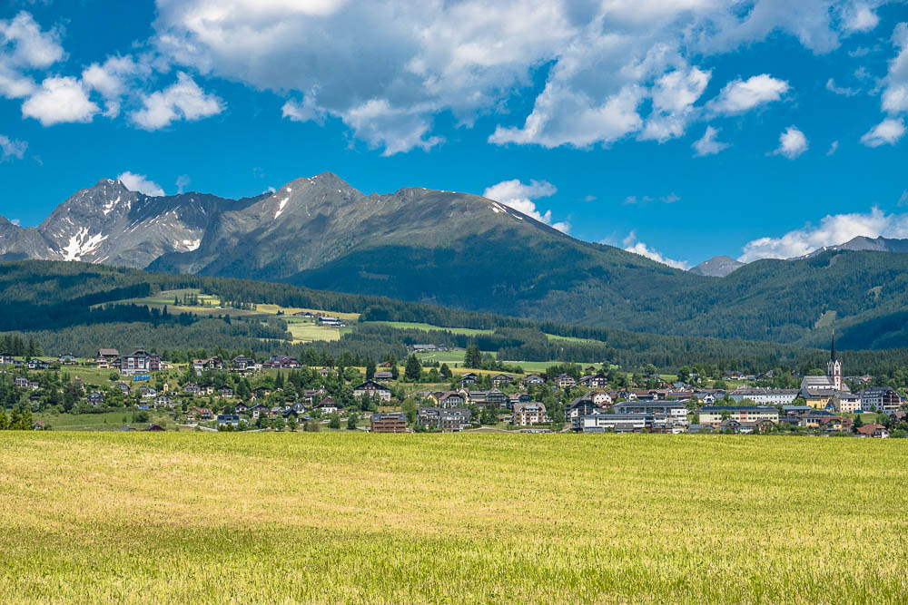
View to the Aineck (2.210 m), the "landmark mountain" of St. Margarethen, with its local skiing centre.

View over still unmowed grassland down to Tamsweg. The low ridge to the left is the Mitterberg, in the distance behind is Preber (2.740 m).

The hamlets of Pischelsdorf and Illmitzen.

View up, with Mauterndorf (hidden far beneath, to the Fanninghöhe and the Gurpitscheck (2.526 m). We will cycle out this valles at the end of our tour.

Gravel banks along the Mur.

With only few pauses, we did the ride down to Tamsweg and, after problems in orientation at the crossing of the main rowd, reached Gröbendorf via Wölting, Stranach and Pichl. Wonderful view to the village of Mariapfarr and to the main Alpine ridge of the Niedere Tauern. Far left Hochgolling (2.863 m), the highest mountain of the Niedere Tauern.
Mariapfarr; I suppose behind to the far left is Kasereck (2.740 m).

More to the right is Roteck (2.742 m) and Preber (2.740 m).

A bit further, shortly before Mauterndorf, an idyllic little pond in the forest.

Opposite the Taurach at the airstrip of Mauterndorf a bench at the Taurach is inviting for a rest.

We enjoy the beautiful area, ...

... and the dogs enjoy the refreshment.


We circumvent Mauterndorf to the left and take a beautful grassland path, a cycle path along the main road and a steep, ugly gravel road down to the Mur valleys and back to St. Margarethen.